File:AfricaLocation.svg

Size of this PNG preview of this SVG file: 463 × 236 pixels. Other resolutions: 320 × 163 pixels | 640 × 326 pixels | 1,024 × 522 pixels | 1,280 × 652 pixels | 2,560 × 1,305 pixels.
Original file (SVG file, nominally 463 × 236 pixels, file size: 290 KB)
Summary
| Description |
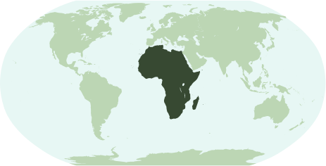
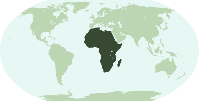
English: Map showing the location of the continent of Africa (including indian ocean islands near Madagascar).
Français : Une carte pour démontrer la location du continent de l'Afrique (avec des îles d'océan indien près de Madagasque).
Interlingua: Un Mapa monstrante le location del continente de Africa (con insulas del oceano indian juxta Madagascar). |
| Date | |
| Source | Own work |
| Mwandiki | Notscott |
Licensing
| I, the copyright holder of this work, release this work into the public domain. This applies worldwide. In some countries this may not be legally possible; if so: I grant anyone the right to use this work for any purpose, without any conditions, unless such conditions are required by law. |
File history
Click on a date/time to view the file as it appeared at that time.
| Date/Time | Thumbnail | Dimensions | User | Comment | |
|---|---|---|---|---|---|
| current | 01:23, 15 mweri wa mbere 2007 | | 463 × 236 (290 KB) | Notscott | {{en|Map showing the location of the continent of Africa (including indian ocean islands near Madagascar).}} {{fr|Une carte pour démontrer la location du continent de l'Afrique (avec des îles d'océan indien près de Madagasque).}} {{ia|Un Mapa monstran |
| 23:50, 14 mweri wa mbere 2007 |  | 463 × 236 (290 KB) | Notscott | {{en|Map showing the location of the continent of Africa (including indian ocean islands near Madagascar).}} {{fr|Une carte pour démontrer la location du continent d'Afrique (avec des îles d'océan indien près de Madagasque).}} {{ia|Un Mapa monstrante |
File usage
The following page uses this file:
Global file usage
The following other wikis use this file:
- Usage on arz.wikipedia.org
- جنوب السودان
- ليبيا
- مصر
- جمهورية كونجو الديموقراطيه
- زيمبابوى
- اسواتينى
- سينيجال
- رواندا
- اوجاندا
- ثيويتا
- الجزاير
- سانت هيلينا
- قالب:افريقيا
- قالب:امريكا الجنوبية/شرح
- قالب:شرح استعمال قوالب القارات
- اريتريا
- شمال افريقيا
- شرق افريقيا
- وسط افريقيا
- كوت ديفوار
- جيبوتى
- بوركينا فاسو
- بوتسوانا
- افريقيا الوسطى
- الاحزاب السياسية فى تونس
- الاحزاب السياسية فى جنوب السودان
- الاحزاب السياسية فى السودان
- الاحزاب السياسيه فى المغرب
- جمهورية الكونجو
- جينيا
- جامبيا
- لغات مصر
- قالب:الاحزاب السياسيه فى دول افريقيا
- قالب:اناشيد دول افريقيا الوطنيه
- قالب:جامعات افريقيا
- Usage on avk.wikipedia.org
- Usage on bi.wikipedia.org
- Usage on bm.wikipedia.org
- Usage on bpy.wikipedia.org
- Usage on cbk-zam.wikipedia.org
- Usage on ch.wikipedia.org
- Usage on en.wikipedia.org
View more global usage of this file.